Building Footprint: What is it and why is it beneficial?
Discover why building footprint is one of the most important sources for understanding an area of interest, how it can be used across a wide variety of industries such as retail, insurance, mapping, and telecommunications.
5 min read
- Published on
October 18, 2022
QUICK SUMMARY
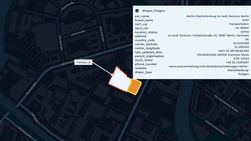
A building footprint is the border of a building drawn along the exterior walls, to create a polygon, representing the total area of the building. There are various sources for collecting building footprint from datasets as cadastral maps, high-resolution satellite images, and open-source projects. At Echo, we utilize building footprints to create accurate polygons. This gives our clients an acute understanding of a place, its habits, and its interaction with the geography around it. This reduces attribution errors and offers a reliable picture of the boundaries, helping businesses make better analyses of their strategies.
TABLE OF CONTENTS
Building Footprint: What is it and why is it beneficial?
What is a Building Footprint?
Sources for collecting Building Footprint:
Where can you get a good-quality building footprint GIS Data?
Industries that use our building footprint dataset to their advantage
Building footprint is one of the most important sources for understanding an area of interest. It is significant data for geospatial analysis that can be used across a wide variety of industries such as retail, insurance, mapping, and telecommunications.
What is a Building Footprint?
A building footprint is the border of a building drawn along the exterior walls, to create a polygon, representing the total area of the building. It usually excludes non-building facilities such as parking lots and streets and provides a better representation of spatial characteristics. A building footprint will include its foundation’s exact size, shape, and location. It also provides a better description of the building’s characteristics compared to only a Point of Interest (POI) analysis by giving information about location, form, floor space, and the relationship between the structure and its surrounding objects.
Sources for collecting Building Footprint:
Available datasets as cadastral maps
These maps provide detailed information about actual buildings in a specific location of interest. The two most commonly used techniques for generating cadastral maps are ground-based surveying and Land Information System (LIS). Ground-based surveying is a remote sensing method to look beneath the surface of the ground. Land Information System (LIS) is helps develop GIS tools that consist of accurate, current, and reliable land records along with their associated attributes and spatial data. In fact, cadastral maps are an excellent way to provide comprehensive and legitimate information to evaluate the characteristics of a piece of land on the surface of the earth. However, one of the drawbacks of using cadastral maps can be they are outdated and the information about the building might not be up-to-date. This makes it difficult for data experts to create accurate building footprints.
High-resolution satellite images
These are the typical sources to generate building footprints and are usually extracted from rooftop segmentation. Rooftop segmentation helps picture buildings from above by creating boundaries around the roof of a particular building. This can be a complex method. Some buildings have roofs larger than the width of the building, which means the boundary will exceed the building’s outline. Satellite imagery might also showcase radiometric errors affecting the brightness of pixels which results in blurred visuals. Distortion in satellite imagery can botch results and have a severe impact on project costs and deadlines. For example, if a house is surrounded by trees an undeveloped algorithm might read it as a garden which changes the whole analysis of the dataset. However, data experts take specific measures to develop algorithms that minimise these flaws.
Open-source projects
Volunteers develop and edit crowd-sourced projects to provide Geospatial Datasets covering physical locations, characteristics, and other features such as parks, buildings, and roads. These user-generated platforms enable developers to add or delete data when needed. If a new building is built or an old one is demolished users can go to the database and add/delete information. However, open-source projects can be vulnerable as they are prone to cyber-attacks and do not provide warranties. Although developers test and make recommendations to strengthen the security process, they will not be held accountable for faulty suggestions.
Where can you get a good-quality building footprint GIS Data?
At Echo, we utilize building footprints to create accurate polygons that give our clients an acute understanding of a place, its habits, and its interaction with the geography around it. This significantly reduces attribution errors and offers a reliable picture of the boundaries, so that you can make better analyses for your business strategy. We provide Places and Shapes datasets that are a combination of high-quality POIs and building footprints. Today industries rely on building footprints to get clarity over the various features of a building, such as the number of floors of the building, its elevation, and its foundation. This information help companies access the risk in investment while also speculating their performance over the upcoming quarter – how the footfall in that area might affect their sales or if the location of the building is suitable for the product that they are selling.
Industries that use our building footprint dataset to their advantage:
1. Retail and advertising
Businesses with offline retail stores utilise building footprints along with their mobility datasets to understand customer patterns and behaviour in a particular location of interest. It gives them a deeper understanding of their customer interactions such as how close they are to the stores, how many people entered and left the store, where they go afterward, and how long they spend at the store. This kind of information allows retailers to craft their advertising strategy and better target potential customers. It can also be a big competitive advantage as businesses can track how many of their customers visit a competitor’s store.
2. Mapping
This doesn’t stay limited to the ancient art of paper maps but extends to the digitized version of the world as we see on Google Maps or any other mapping platform. Building footprints in cartography not only help outline the buildings on a map but also give an understanding of how the building interacts with its surroundings. In such cases, the building footprint is combined with shapes or polygons to better define the structure on the map.For example, some buildings might have a special design to meet their geographical constraints – like the mountain buildings have titled roofs to avoid water stagnation during a rainy season. Or it might just be an aesthetic choice – like an architect who wants to build a house based on the latest, unique designs. In the case of malls, schools, or any large campus it can be especially complex since the POI will trace to only one point but the building itself will have multiple points. In such cases, the building footprint is combined with shapes or polygons to better define the structure on the map.
3. Insurance
For insurance companies who specifically deal with properties understanding an area, its buildings, and how they interact with their surroundings is important. Suppose an insurance company is trying to insure a building in an industrial area, it needs to know what is in the building’s vicinity, if there are any potential hazards or if the area is prone to accidents. It helps insurers access the vulnerability of the place. If the building is in a low-lying area it can be at a greater risk of being hit by a flood. Having this kind of information helps insurance companies with risk assessment.